TL;DR
Yes, you can buy land without seeing it in person. Remote land purchases are possible when you replace an in-person visit with thorough research, professional inspections, and a careful due diligence process.
Before buying land sight unseen, make sure you:
- Verify the seller’s ownership and the property’s legal description.
- Review county assessor, recorder, and GIS records.
- Confirm legal road access and any recorded easements.
- Check zoning and permitted land uses.
- Review flood maps and other environmental concerns.
- Investigate utilities, septic feasibility, and road conditions.
- Order a title search and consider title insurance.
- Hire a local professional to inspect or document the property.
- Consider a survey when boundaries or access are uncertain.
- Include appropriate contingencies in your purchase agreement.
- Close through a reputable title company or real estate attorney.
The goal is simple: you do not have to physically stand on the land to make an informed decision, but you do need to verify what you are actually buying.
Introduction: Can You Really Buy Land Without Seeing It?
Imagine finding an affordable parcel of land that checks almost every box on your wish list. It is in a desirable location, the price fits your budget, and it could eventually become your homesite, recreational property, farm, or long-term investment.
There is just one problem: the property is hundreds or even thousands of miles away.
Does that mean you have to pass on it?
Not necessarily. You can buy land without seeing it in person, and remote land purchases have become increasingly practical thanks to online county records, GIS mapping systems, satellite imagery, video calls, drone footage, and local professionals who can visit the property on your behalf.
However, buying land sight unseen should never mean buying land without doing your homework. A listing can make a parcel look perfect while leaving out important details about access, zoning, terrain, utilities, taxes, boundaries, or title issues.
The good news is that many of these questions can be answered before you close.
With the right process, you can investigate a property remotely, identify potential problems, and make a decision based on verified information instead of relying solely on photographs or a seller’s description.
What Does It Mean to Buy Land Without Seeing It in Person?
Buying land without seeing it in person means purchasing a property without physically standing on the parcel before the transaction closes.
Instead of visiting the property yourself, you may:
- Research county property records online.
- Review GIS parcel maps.
- Examine satellite and aerial imagery.
- Study flood maps.
- Confirm zoning with the local planning department.
- Order a title search.
- Hire a surveyor or local real estate professional.
- Request photographs and videos.
- Arrange a drone inspection.
- Complete the closing remotely through a title company or attorney.
This approach is commonly called buying land sight unseen or buying land remotely.
Importantly, sight unseen does not have to mean uninformed.
In some situations, a careful remote buyer may actually collect more documentation than someone who visits a property once and bases the decision primarily on what they see during a short tour.
Why Do People Buy Land Remotely?
There are several reasons someone might purchase land without visiting it first:
- They found a better-priced parcel in another state.
- They are looking for a future retirement property.
- They want recreational or rural land.
- They are purchasing land as an investment.
- Traveling to the property is difficult or expensive.
- They want to act quickly when a suitable parcel becomes available.
- They live far away from the area where they want to purchase.
Remote buying can work well, but it requires an investigative mindset.
Instead of asking only, “Does this land look good?” you should ask, “Can I verify that this property works for my intended use?”
That means confirming what you are buying, what you can legally do with it, how you can access it, and what additional costs you may face.
Is It Safe to Buy Land Sight Unseen in the U.S.?
It can be safe to buy land remotely, provided you complete appropriate due diligence before closing.
The biggest mistake remote buyers can make is assuming that an attractive listing, low purchase price, or confident seller automatically means the property is problem-free.
Property information is often available through public records. Depending on the county, assessor and recorder websites may provide information about ownership, property taxes, acreage, legal descriptions, assessed values, and recorded documents.
Many counties also provide GIS mapping systems that allow buyers to examine parcel boundaries, roads, surrounding properties, and other geographic information.
A title search is another essential part of the process. It can help determine whether the seller has the legal right to transfer the property and may identify issues such as liens, easements, competing claims, or other recorded interests affecting the property.
So, can you buy land without seeing it in person safely?
Yes, but the protection comes from verification and due diligence, not from simply trusting the listing.
The Biggest Risks of Buying Land Remotely
Every land purchase carries some level of risk, and remote purchases can create additional challenges because you cannot personally inspect the property before committing.
Understanding the most common problems can help you know what to investigate.
1. No Legal Access
A parcel can appear to be conveniently located beside a road on a map while having no legally established access.
You need to determine whether the road is public, private, maintained, and legally available for you to use. If access depends on an easement, review the recorded easement documents carefully.
2. Zoning Restrictions
A parcel may not allow the use you have in mind.
For example, local rules could restrict whether you can:
- Build a house.
- Place a manufactured home.
- Park or live in an RV.
- Keep livestock.
- Operate a business.
- Build a cabin.
- Develop the property in a particular way.
Always confirm zoning with the appropriate local planning or zoning department rather than relying solely on a listing description.
3. Flood Exposure
Some land may be located in a flood-prone area or a designated flood zone.
Flood risk can affect construction, insurance requirements, site planning, and the overall practicality of the property. Reviewing current flood maps is an important part of remote land due diligence.
4. Unclear Property Boundaries
The boundaries shown in online listings, old photographs, fences, or informal maps may not accurately represent the property’s legal boundaries.
When boundaries are important, especially for development or when neighboring properties are close, consider hiring a licensed surveyor.
5. Utility Problems
A rural parcel may not have convenient access to electricity, public water, sewer, natural gas, or internet.
Even when utility infrastructure appears nearby, connecting a property can involve substantial costs.
6. Hidden Liens or Unpaid Taxes
Unpaid property taxes, liens, judgments, or other title issues can complicate a transaction.
A title search and appropriate closing process can help identify potential problems before ownership changes hands.
7. Difficult Terrain
Satellite images do not always tell the whole story.
Steep slopes, rocky soil, dense vegetation, standing water, poor drainage, or other terrain conditions can make construction or access more difficult.
8. A Cheap Price With a Reason
A parcel that appears to be an incredible bargain may have a reason for its low price.
It could be landlocked, difficult to build on, subject to restrictions, lacking utilities, or otherwise challenging to develop or resell.
These issues do not automatically mean you should reject a property. They mean you need clear answers before closing.
How to Research Land Before You Buy
The first stage of a remote land purchase should be research.
Fortunately, much of the information you need can be found online or confirmed with a phone call.
Check County Property Records
Start with the county assessor or treasurer website.
You may be able to search using the property’s parcel number, owner name, address, or other identifying information.
Review details such as:
- Current owner.
- Parcel size.
- Legal description.
- Assessed value.
- Property tax status.
- Ownership history.
- Outstanding tax issues.
Next, check the county recorder or clerk’s office for recorded documents.
Look for deeds, mortgages, liens, easements, and other recorded restrictions that could affect the property.
Do not rely entirely on the seller’s summary of the property. Whenever possible, verify important information through the appropriate public records.
Use GIS and Satellite Maps
County GIS portals can provide valuable information about a parcel.
You can often examine:
- Property boundaries.
- Nearby roads.
- Neighboring parcels.
- Terrain.
- Nearby development.
- Water features.
- Geographic location.
- Surrounding land uses.
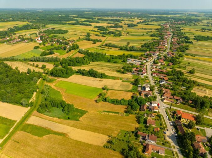
Satellite imagery and tools such as Google Earth can provide another useful perspective.
Look at the parcel from above and compare current imagery with older imagery when available. Changes over time can sometimes reveal development, drainage patterns, cleared areas, or other details that are not obvious from a listing.
Pay Special Attention to Access
One of the most important questions is whether a road actually provides legal access to the property.
Do not assume that a road visible on a map is automatically a public road or that you have the legal right to use it.
Investigate the road’s status and determine whether access depends on a recorded easement.
Verify Zoning and Permitted Land Uses
Zoning determines how property can legally be used.
If you are buying land to build a house, place a manufactured home, park an RV, keep animals, operate a small farm, or use the property for another specific purpose, confirm that your plans are permitted.
Start with the county or local planning department.
Review the zoning map and applicable regulations, then contact the office if anything remains unclear.
Whenever possible, obtain written confirmation about the intended use. A written response can provide useful documentation when you are making a significant purchase.
Do not assume that because another nearby property has a house, cabin, RV, or other structure, you will automatically have the same development rights.
Documents and Checks Every Remote Buyer Needs
A remote land purchase should be supported by organized documentation and professional checks.
Important items may include:
Preliminary Title Report or Title Search
A title search helps verify ownership and identify recorded issues such as liens, easements, encumbrances, or other claims affecting the property.
Title Insurance
Title insurance can provide protection against certain covered ownership defects that existed before closing.
Property Survey
A survey can establish property boundaries and may identify encroachments or other issues involving the parcel.
A survey becomes especially valuable when boundaries are unclear, the property has an unusual shape, or neighboring properties are close.
FEMA Flood Map Review
Review applicable flood maps to understand whether the property is located in an area with identified flood risk.
This information can also help you understand potential insurance and development considerations.
Zoning Confirmation
Confirm the property’s zoning and intended use with the appropriate local authority.
Written confirmation can be especially useful when your plans depend on a particular use being permitted.
Tax Status Verification
Make sure property taxes are current and determine what ongoing tax obligations you can expect after purchasing the property.
Utility and Access Research
Investigate the availability and potential cost of:
- Electricity.
- Water.
- Well installation.
- Septic systems.
- Internet.
- Road access and maintenance.
Purchase Agreement Contingencies
Consider making the purchase agreement contingent on the results of important due diligence.
Depending on the transaction, contingencies may address:
- Title.
- Survey.
- Legal access.
- Zoning.
- Inspections.
- Septic feasibility.
- Other property-specific concerns.
If the property will require a septic system, ask about a perc test. This evaluates whether the soil can properly absorb wastewater from a septic system.
How to Inspect Land Without Being There
Not being physically present does not mean you have to accept a limited view of the property.
There are several ways to conduct a remote inspection.
Use Aerial and Satellite Imagery
Examine current satellite images as well as historical imagery when available.
Look for:
- Drainage patterns.
- Low-lying areas.
- Vegetation.
- Cleared sections.
- Nearby construction.
- Potential erosion.
- Water features.
- Changes over time.
Street-level imagery can also be helpful when available, especially for examining nearby roads and surrounding development.
Order Drone Footage
A local drone operator can provide aerial video that gives you a much more detailed view of the property.
Drone footage may help you evaluate:
- Terrain.
- Vegetation.
- Approximate boundaries.
- Road access.
- Surrounding properties.
- Drainage.
- Overall site conditions.
This can be especially useful because a flat satellite image may not clearly show elevation changes or other physical characteristics.
Hire Someone Local to Visit the Property
One of the most effective ways to inspect land remotely is to hire someone who can physically visit the parcel.
Depending on your needs, that person could be a:
- Local real estate agent.
- Surveyor.
- Property inspector.
- Property manager.
- Other qualified local professional.
Ask them to take detailed photographs and videos, verify GPS locations when appropriate, examine road access, and report visible concerns.
A boots-on-the-ground inspection can provide information that online research simply cannot.
Request a Live Virtual Walkthrough
You can also ask the seller or agent to conduct a live video walkthrough.
Rather than asking for a general tour, request footage of specific areas.
For example, ask them to show:
- The road entrance.
- The approximate property corners.
- Low spots.
- Nearby structures.
- Utility poles.
- Access roads.
- Surrounding properties.
- The view from different areas of the parcel.
Specific requests make it easier to spot details that a casual video might overlook.
When Should You Visit the Property in Person?
Although remote buying can work, there are situations where visiting the property yourself may be worthwhile before closing.
Consider traveling to the property when:
- You plan to build a home soon.
- The purchase price represents a significant portion of your budget.
- Road access is uncertain.
- The access road is unmaintained.
- You need to evaluate views or noise.
- You are concerned about neighboring properties.
- Seasonal conditions could affect the land.
- The seller resists inspections or surveys.
- The property has complex boundaries.
- The property contains water features.
- The terrain is steep or difficult.
A personal visit can also give you a better understanding of the surrounding community.
Photographs may not reveal how close the property is to a busy highway, industrial facility, commercial area, or other source of noise.
Likewise, a parcel that appears dry during one season could experience very different conditions during another.
A Simple Step-by-Step Process for Buying Land Remotely
If you are ready to investigate a remote land purchase, use a structured process.
1. Define Your Goal
Determine what you want to do with the property.
Are you planning to:
- Build a home?
- Camp?
- Farm?
- Create a recreational property?
- Invest?
- Hold the land long term?
Your intended use will determine which questions matter most.
2. Set Your Complete Budget
Do not look only at the purchase price.
Include potential costs for:
- Closing.
- Taxes.
- Title work.
- Surveying.
- Inspections.
- Utilities.
- Access improvements.
- Septic work.
- Other site improvements.
A low purchase price does not necessarily mean low overall costs.
3. Find the Parcel Number
Ask the seller or listing agent for the property’s parcel number before making an offer.
The parcel number can make it much easier to locate the correct property in county records and mapping systems.
4. Research County Records
Confirm ownership, taxes, acreage, legal description, and recorded documents.
Compare the public records with the information in the listing.
5. Study the Maps
Review GIS maps, satellite imagery, flood maps, and road access.
Look at the parcel itself as well as the surrounding area.
6. Confirm Zoning
Contact the local planning or zoning department.
Confirm that your intended use is permitted and document the response whenever possible.
7. Order a Title Search
Work with a qualified title company or real estate attorney familiar with property transactions in the state where the land is located.
Review the results carefully before moving forward.
8. Get Local Eyes on the Property
Hire an appropriate local professional to visit the property.
Request detailed photographs, video, and information about access, terrain, surrounding conditions, and other concerns.
9. Use Appropriate Written Contingencies
Do not casually waive important protections.
Consider contingencies related to title, survey, access, zoning, inspections, and other issues that matter to your purchase.
10. Close Through a Reputable Professional
Use a reputable title company or real estate attorney to handle the closing.
Avoid informal arrangements where money changes hands before ownership and title have been properly verified.
Example: Buying Land in Another State
Suppose you live in Illinois and discover a five-acre parcel in Arizona.
The first step is to obtain the parcel number and review the county assessor’s records. You confirm the property’s ownership information and verify that taxes are current.
Next, you examine the GIS map and satellite imagery.
The map shows a dirt road leading toward the property, but you do not assume that the road provides legal or practical access. Instead, you ask a local agent to visit the property and drive the road.
During the visit, the agent confirms that the road is passable but discovers that electrical service is approximately half a mile away.
You then contact the appropriate local office and confirm that the zoning allows a single-family home.
Before closing, you order a title search, review applicable flood information, and obtain a boundary survey.
You still have not physically stood on the property yourself.
However, you have gathered information about access, zoning, title status, flood considerations, boundaries, and utility availability.
That is the difference between buying land sight unseen and buying land blindly.
Red Flags That Should Make You Pause
Not every warning sign means you must automatically abandon a property. However, certain situations deserve serious attention and additional investigation.
Watch for these red flags:
- The seller cannot provide a parcel number.
- The legal description is unclear.
- The seller pressures you to close immediately.
- The seller discourages title work.
- Legal access cannot be verified.
- Zoning does not permit your intended use.
- The seller refuses to allow a survey or inspection.
- Property taxes are delinquent without a clear explanation.
- The price is dramatically lower than comparable properties without an obvious reason.
- Maps, photographs, and the seller’s description do not match.
- The seller asks you to send money directly instead of using an appropriate closing professional.
A seller who is comfortable with legitimate due diligence should generally understand why a buyer wants to verify the property before closing.
If someone tries to discourage reasonable research, treat that as important information and investigate further.
Final Thoughts: Buy Land From Anywhere With Confidence
Can you buy land without seeing it in person? Absolutely.
The important question is not whether you physically visit the property. The important question is whether you have gathered enough reliable information to understand what you are purchasing.
County property records, GIS maps, satellite imagery, flood maps, title searches, surveys, zoning confirmation, utility research, and local inspections can help you build a detailed picture of a property from a distance.
Before committing, confirm the property’s ownership, legal access, zoning, boundaries, taxes, utilities, terrain, and other factors that could affect your plans.
If the property meets your requirements and the necessary due diligence checks out, a remote purchase can be a practical way to acquire land outside your local area.
Take your time, verify the important details, use qualified local professionals when needed, and keep the transaction organized from beginning to end.
The goal is not simply to find inexpensive land. It is to understand exactly what you are buying, what you can do with it, and what it will realistically take to make the property work for you.
This post is generated by Chatgpt.